As 2024 comes to a close, we are dedicating the final two weeks to a countdown of the year’s most-read stories. Covering a wide range of local topics, these pieces reflect the varied interests of our readers and offer a moment to look back before turning toward 2025. Join us as we revisit the highlights that shaped the year. Original run date: March 7, 2024.
Support Independent Local News
As we celebrate the past year, we also reflect on the future of independent local journalism. Napa Valley Features remains ad-free, conflict-of-interest free and locally owned but depends on reader support to continue. With nearly 4,300 subscribers and fewer than 1,000 paid, even small contributions — just 16 cents a day — can make a big difference. Your support ensures Napa Valley Features stays independent, relevant and a trusted voice for our community.
NAPA COUNTY, Calif. — Lake Berryessa is almost a living creature. It breathes in and out, grows and shrinks. But it breathes water, not air. It breathes in through rainfall and runoff during the winter season and breathes out all year through evaporation and the outflow pipes of Monticello Dam.
The Lake Berryessa region encompasses a large part of eastern Napa County. The lake was formed in the Berryessa Valley, which was a major agricultural resource for Napa County and exported tons of produce before the lake was formed in 1958. If the dam had not been built, it is conceivable that the Berryessa Valley could have become another bedroom community of 5,000 homes like the present adjacent communities. The Lake Berryessa Technical Manual: The Science, Engineering, History, and Humor of a Major Unnatural Resource explains the history and answers the question: Why does Lake Berryessa exist? The early exuberant development years of the Lake Berryessa area are described in Lake Berryessa 1960: How It Coulda, Woulda, Shoulda Been.
The oddest detail about this subject is that although Lake Berryessa is entirely within Napa County, almost none of the water goes to Napa except for some small amounts to serve the few rural communities that border the lakeshore. The dam was built to supply irrigation and drinking water to Solano County; recreation was never one of the project’s goals. Solano County financed the dam, paid off the loans and now owns the water. The process is documented in Napa Opposes Building the Monticello Dam.
The Solano Irrigation District manages Monticello Dam and controls the output per law and contract. The water released supports the downstream fishery in Lower Putah Creek and provides drinking water for 500,000 people in Solano County. The Solano County Water Agency manages water distribution. The minimum output is 45 CFS (89 A-F/day). During the summer growing season the output can reach 700 CFS (1,387 A-F/day). Note: 1 cubic foot per second (CFS) equals 1.98 acre-feet per day (A-F).
Lake levels vary considerably from year to year. Some folks use a rule of thumb that the lake increases a foot for every inch of rainfall after the ground has been saturated by 2 to 3 inches of rain and runoff begins. This easy-to-remember rule is not completely accurate since the relationship between the lake level and its storage capacity is not linear. The lake profile is roughly a V-shaped bowl or funnel with peaks and valleys, inlets and large flat areas, which means that the higher the water level gets the more rain is needed to raise it farther. At the higher levels the lake rises only 7 inches per inch of rainfall.
The Lake Berryessa watershed encompasses the 576-square-mile area primarily fed by Putah Creek, which originates from springs on the east side of Cobb Mountain in Lake County. Putah Creek enters Napa County about 11 miles east of Middletown and merges with Butts Creek just before it empties into Lake Berryessa. Therefore, rainfall over the Cobb Mountain and Middletown areas provides the bulk of water entering Lake Berryessa. One reason that Lake Berryessa rose so quickly in 2017 was the very heavy rainfall that occurred on Cobb Mountain and in the Middletown area.
Lake Berryessa is considered "full" when the level hits 440 feet msl (above mean sea level). That is the height of the lip of the Glory Hole spillway.
Does Lake Berryessa Sweat in the Summer?
Sunlight and the air temperature support the change of lake surface water to vapor. Lake Berryessa has its own evaporation losses, which are small but noticeable — up to 1 foot evaporation lake level decrease per month during summer months. As incredible as it may seem, more Lake Berryessa water is lost to evaporation during the summer than is released from the lake during the winter.
How Much Water Does Lake Berryessa Hold?
Let’s start with some simple arithmetic:
1 cubic foot per second equals 1.98 acre-feet per day.
1 A-F of water equals 1 foot of water on a 1-acre surface.
The required minimum output at Monticello Dam is 45 CFS or to 89.1 A-F per day.
Lake Berryessa surface level is about 20,700 acres when full.
Human water equivalent to horses, cows, chickens and pigs:
1 human family (up to 5 people) uses 1 A-F per year.
1 dairy cow or horse uses .038 A-F per year.
300 chickens or 3 pigs use .017 A-F per year.
Therefore, 1 human family = 26 cows, 26 horses, 176 pigs or 17,648 chickens.
Glory Hole History
Before 2017 Glory Hole had overflowed only 25 times in the 59 years since the dam was finished in 1958. By 2024 that number had risen to 27 times in 66 years. (See the small numbers on the lake level chart below.)
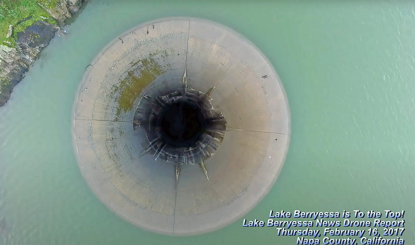
Friday, Feb. 16, 2024, was the seventh anniversary of the dramatic rise of Lake Berryessa as it finally spilled over Glory Hole on that day in 2017 after an 11-year drought. 2017 was an exciting year at Lake Berryessa, as the lake became internationally famous. Evan Kilkus captured the historic glory days of Glory Hole with his drone.
Feb. 17, 2017: Lake Berryessa Is Full & Splashing Over the Spillway
Feb. 18, 2017 Lake Berryessa Is Spilling 1 Foot Over Glory Hole
The previous videos put Lake Berryessa on the map to a U.S. audience, but this next video brought the lake to more people around the world. This YouTube video has had more than 61 million views, and since 2017 the footage has been used in dozens of videos and photo stories internationally, showing curious TV and internet viewers this unique spillway design.
Feb. 21, 2017 Lake Berryessa is 3.5' OVER the Glory Hole Spillway
The lake did overflow Glory Hole again (twice officially) in 2019, but as of March 5 has been below it since then.
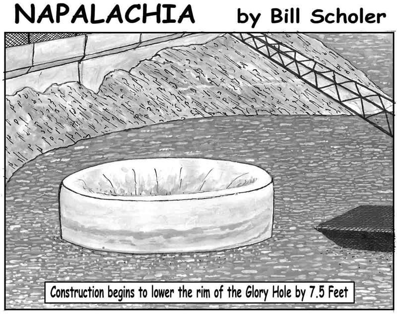
The Glory Hole overflow in 2019 was also a major attraction and again drew thousands of tourists to the lake, adding positive economic impacts to the towns around the lake, especially the City of Winters. Bill Scholer, Lake Berryessa News cartoonist, illustrated a proposal to increase lake visitation.
How Does the Glory Hole Work (and Why the Name)?
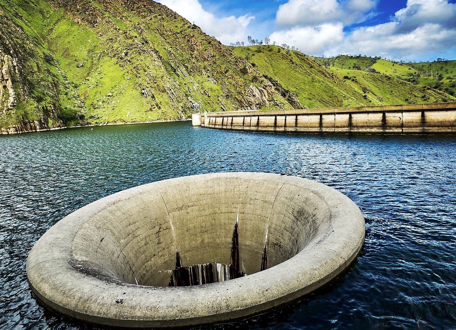
The Monticello Dam features a morning glory spillway. This type of spillway is basically a giant cement funnel. Rather than spilling over the dam, high waters spill into the funnel. Morning glory spillways are also known as bell-mouth spillways. For many people who see Glory Hole the question that arises is why this hole and not a more typical spillway? The answer is space.
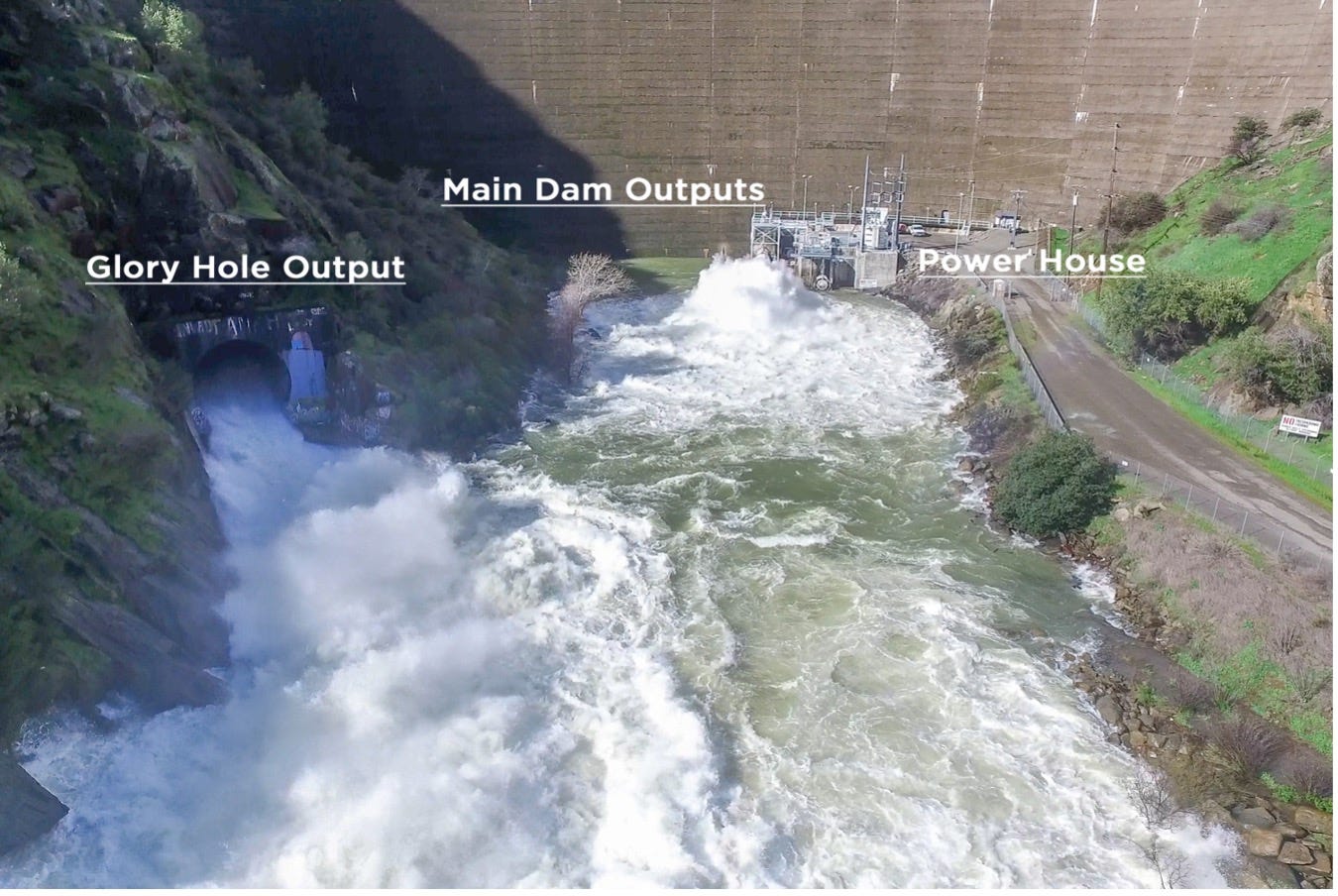
The Monticello Dam sits at the Devil’s Gate in a narrow canyon. While the site was a good spot to build the dam, it did not have enough space to build a big channel and overflow berm. Engineers decided the best way to get overflow water, if required, to the other side of the dam was to dig down. They tunneled through rock to reach a tunnel that had already been built to divert Putah Creek during dam construction. That original tunnel now acts as the spillway for Glory Hole.
The Monticello Dam's spillway is otherwise (and affectionately) known as Glory Hole. It is located about 200 feet from the dam. Water spills over its lip when the lake reaches 1,551,300 A-F and a reservoir elevation of 440 feet above mean sea level. The funnel's largest diameter is 72 feet, and it narrows to about 28 feet. It is designed to handle a maximum of 362,000 gallons of water per second (48,400 cubic feet per second or 96,000 acre-feet per day), which could occur in the unlikely event that the lake level rises to 15.5 feet above the level of the funnel — which is almost the height of Monticello Dam (456 feet above mean sea level).
If the lake ever reached 455.5 feet msl, the system is designed so that water would first go over Highway 128 before it overtopped the dam. The highest level the lake ever reached was 446.7 feet msl in 1983. The crest of Glory Hole sits 16 feet lower than the crest of the dam. The lip of the spillway is curved so there is little resistance to the water’s flow. It is a very efficient, smooth laminar flow and not very turbulent for most of the distance. Glory Hole is essentially a circular waterfall.
Here's a very good four-minute video description of how Glory Hole works broadcast by Sacramento's ABC10 in 2019 and showing a fully flowing Glory Hole.
Video: How Does 'The Glory Hole' at Lake Berryessa Work?
If today’s story captured your interest, explore these related articles:
Peter Kilkus: nearly two decades of hyper-local news reporting in Napa County
Facebook group warns Napa Valley commuters of traffic tie-ups + Sounds of summer
Calistoga's Old Faithful Geyser: from tourist trap to natural wonder
Peter Kilkus is a Napa-County-based journalist who has owned and operated the Lake Berryessa News since 2009.


Very cool! This lake is a hidden gem in plain sight in the Napa Valley. Peter is the historian.